
Background
IN1303 | |
Rif Field Station | |
Sub-Arctic | |
Open | |
Station | |
Iceland | |
Station | |
2014 | |
Year-Round |
Introduction
The Rif Field Station is a non-profit organisation named after the peninsula of Rif, in the northernmost part of Iceland. | |
The station is located in Raufarhöfn, a small fishing village on the northeast coast of the Melrakkaslétta peninsula in Northeast Iceland. The peninsula is the northernmost lowland area in Iceland, only 3 km south of the Arctic Circle. The northern part of the peninsula is an important area for conservation, especially as a habitat for many bird species. The area has no protection status according to the Nature Conservation Act, but is listed as an internationally Important Bird Area (IBA) by BirdLife International. Most of the area is privately owned but some of the abandoned farms are owned by the Government of Iceland. | |
The northern coast of Melrakkaslétta is highly exposed to cold northerly winds. Fog is frequent along the coast. The coast is characterized by algae rich gentle sloping gravel banks with numerous open and land-locked bays, inlets, salt marshes, and brackish lagoons. Low average summer temperature and high humidity affect the vegetation in the area, and plants of arctic origin are characteristic for the area. At least 53 species of birds have been found breeding in the area, and seabirds, waterfowl, and waders occur frequently in the area. Rock ptarmigan and purple sandpiper are found breeding in high densities. The shores of Melrakkaslétta are used by locally breeding birds as well as up to 20000 arctic waders on their way to the breeding grounds in Greenland and arctic Canada. | |
Rif Field Station was established in 2014. The station is currently housed in a three-floor building, partly run as a guesthouse. Accommodation facilities include two bedrooms, a kitchen, a living room, and a bathroom. It is available for 6-8 persons at a time. Laboratory and storage facilities are located in the basement. Accommodation for larger groups can be provided in a nearby guesthouse. In Raufarhöfn there is a grocery store, a hotel, a restaurant, a coffee shop, a bank, a post office, a health care centre, and a swimming pool. The station has unlimited access to the land of Rif, the northernmost part of Iceland, for scientific purposes. | |
The Rif Field Station is in its development stage. Research will include basic monitoring projects on weather/Climate Change, vegetation, and birds. Long-term research will be conducted on arctic species like rock ptarmigan, gyrfalcon, arctic tern, and purple sandpiper as well as on high arctic migratory birds. Data on climate dates back to 1920. Arrival dates for different bird species has been registered since 2001. | |
For centuries sheep farming was practiced along the northern coast of Melrakkaslétta, supplemented with some small scale fishing by farmers, both at sea and in freshwater lakes. Farmers also benefitted from the large amount of driftwood that washed up on the shore. Today most of these farms have been abandoned, although some are still used as summer houses. . The village of Raufarhöfn (180 inhabitants), with its great natural harbour, was established for fishery, and eider down is still collected in large eider colonies. | |
Raufarhöfn is easily accessible by car, on paved road all the way from Reykjavík. The nearest domestic airports are at Þórshöfn (67 km), Húsavík (130 km), and Akureyri (222 km). Eagle Air operates flights from Reykjavík to Húsavík, and Air Iceland from Reykjavík to Akureyri. Norlandair operates flights between Akureyri and Þórshöfn. A limited scheduled bus service is available between Akureyri, Húsavík, and Raufarhöfn. |
Operator
Rif Field Station | |
Other | |
Non-profit organization | |
Northeast Iceland Nature Research Centre | |
lindi@nna.is |
Data Source
Partner Institution
Yes | |
Icelandic Institute of Natural History, University of Iceland, University of Akureyri, The Agricultural University of Iceland, Stefansson Arctic Institute |
Location
IN1303 | |
66° 27' 0'' N | |
15° 57' 0'' W | |
European Arctic | |
1 | |
0 | |
284 | |
0 | |
0 | |
0 | |
0 | |
Ice-free ground |
Climate
Continuous | |
Sub-Arctic | |
Snow and Rain | |
650 | |
23 | |
108 | |
N | |
3.4 | |
-0.7 | |
9.1 | |
January; February; March; April; May; June; July; August; September; October; November; December | |
March; April | |
May; June; July; August; September; October |
Features
Lake; Mountain; Rivers; Shoreline; Other | |
Peatlands; Wetlands; Human settlements or resource use in the area; Salt marshes; inlets and brackish salt lagoons; sea cliffs; lichen rich heathland |
Disciplines
Anthropology; Archaeology; Climatology; Climate change; Environmental sciences; Fishery; Hydrology; Limnology; Mapping; Marine biology; Oceanography; Pollution; Terrestrial biology | |
Ecosystem services |
Human Activities
Yes | |
* | |
Yes | |
Yes | |
Yes | |
Yes |
Infrastructure
IN1303 | |
66 | |
15 | |
Possibility of accommodating larger groups | |
0 | |
0 | |
8 | |
Yes | |
Yes | |
230 | |
24 |
Staff Capacity
1 | |
0 | |
1 | |
0 | |
8 | |
0 |
Scientific Equipment
* |
Medical Facilities
Yes | |
0 | |
0 | |
130 | |
0 | |
0 | |
0 | |
1 | |
Mobile phone for field work | |
First aid kit for field work | |
Yes |
Vehicles
None but possibility of renting a boat in Raufarhöfn | |
None – rental cars available |
Workshop facilities
ICTS (Staff available to assit with constructions) | |
* |
Communications
Internet; Printer; Scanner; Telephone |
Access
IN1303 | |
Land |
Aircraft landing facilities
0 | |
0 | |
0 | |
* | |
Yes |
Transport and freight
Car | |
0 | |
0 |
Access To The Facility
Yes | |
Jónína Sigríður Þorláksdóttir | |
rif@nna.is |
Pictures
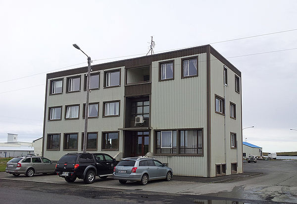 Main building (Credits: Yann Kolbeinsson) |
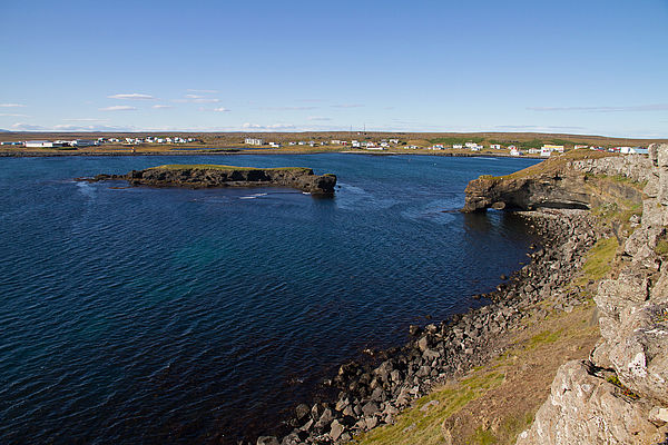 Raufarhofn Village (Credits: Yann Kolbeinsson) |
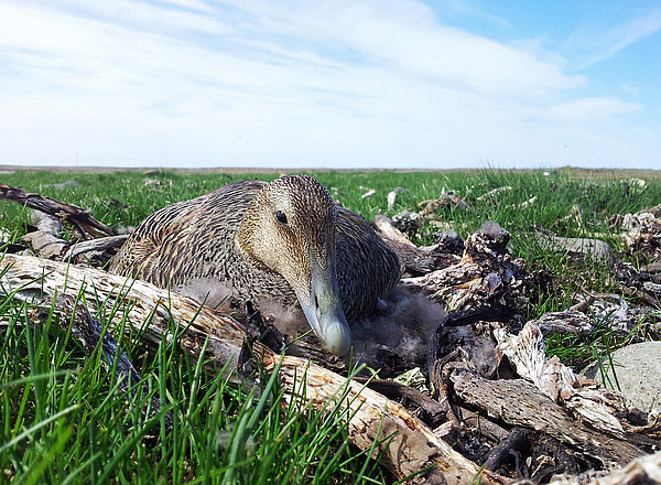 Common eider (Credits: Yann Kolbeinsson) |
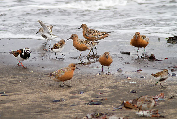 Shorebird migration (Credits: Yann Kolbeinsson) |
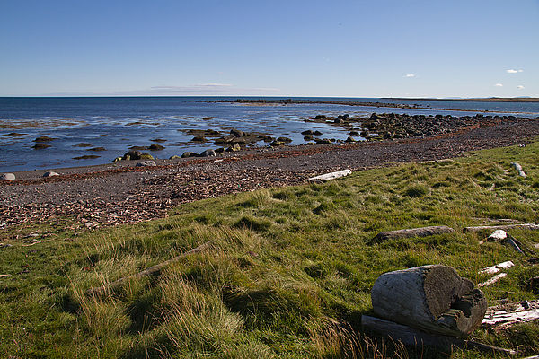 Coastal area with driftwood - Melrakkasletta (Credits: Yann Kolbeinsson) |
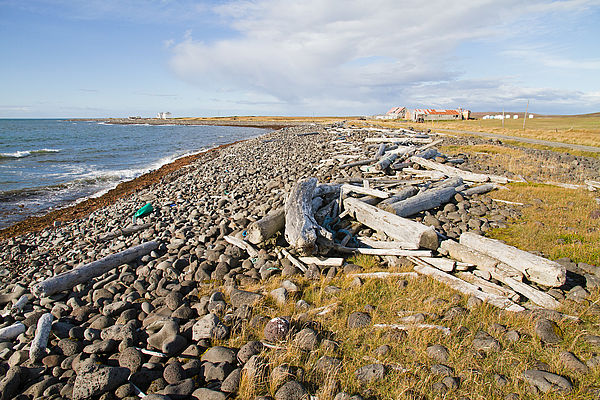 Coastal area with driftwood and houses - Melrakkasletta (Credits: Yann Kolbeinsson) |
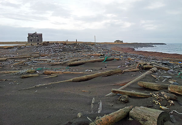 Rif Farm at coast (Credits: Yann Kolbeinsson) |